Expert Judgement Application
Expert Judgement Application allows to organise the work of experts to determine whether agricultural parcels comply with the Common Agricultural Policy (CAP) regulations by analyzing signals, markers, and auxiliary data.
Package bundles are used to organize the work of experts. A package bundle defines a collection of task packages, including the number of task packages in the bundle, the task to be performed, and the associated agricultural parcels. A task package represents the task to be performed on the associated agricultural parcels, which can be assigned to an expert.
Expert Judgement Application supports the following functionalities:
- creation of packages in the administrative module with tasks for:
- collection of the ground truth data,
- marker validation and
- traffic light review module
- insight into the status of the FOIs included in the subsidy applications:
- traffic light calculation results (including markers used in the calculation, model scenarios, model decisions, expert decision results and final traffic light results with transparent history overview)
- review of the auxiliary data (satellite images and signals, orthophoto images, subsidy applications attribute data etc.),
- reports on several levels (per farm, per application, per marker).
Administrative module
The administrative module is the central access point for reviewing traffic lights, providing an overview of package bundles and work distribution among users.
Below you can find it's user interface.

Besides an overview of created bundles and packages (each user receives assigned packages in their inbox), the administration module allows detailed tracking of progress on FOI, claim, or eligibility criteria levels within the reporting tabs. An example is shown below.

You can easily filter millions of FOIs, check their status, export them, or edit them using the Traffic Light Review module by simply clicking on the FOI ID from the list.
As Expert App plays a central role for Paying Agencies for Traffic light decision making, it also enables creation of tasks for communication with farmers who submit claims. Check out example below. With help of this component, farmers can be notified via e-mail, SMS, or our Geotagged Photo Application.

Speaking of Geotagged Photo App - we can also mention that all geotagged photos can be shown in the Expert app providing experts additional information for decission making in examples where claim cannot be checked with remote sensing data.

Traffic Light Review (TL) module
The Traffic Light (TL) Review module offers a graphical interface for expert analysis of computed signals, markers, and auxiliary data to determine whether agricultural parcels comply with CAP regulations. Based on the expert's decision, a traffic light status is assigned.
 Example of TL review module in the action. FOI was is marked as non-compliant by our TL model as it is heterogenous with 2 different crops growing on it. Expert decided to confirm TL model decision. 4 different eligibility criterias were check for this claim (shown in the right task table) - agricultural use detection, homogeniety, compliance with non-agricultural land use rules and land use cross-check with tthe one defined in the claim.
Note that all TL changes are transparently shown in TL history table clearly showing exact dates of the change with description of the trigger which caused TL color change.
Deatiled description of visualization components which you can see on the screenshot can be found here.
Once you are done with the review of all tasks, simply finish it with a click on a button and proceed with the next one. Results are now saved and you can access them anytime.
Ground truth collection (GTC) module
In order to have optimal marker results, ground truth data is of outmost importance thus GT model idea was born.
In the wizard for package bundle creation, define the labels you want to collect (whether at the observation or FOI level) and immediately start labeling. For observation-level GTC (e.g., mowing or bare soil presence on a specific date), use mouse clicks. For FOI-level GTC (useful in land-use assessment), you can label even faster using keyboard shortcuts.
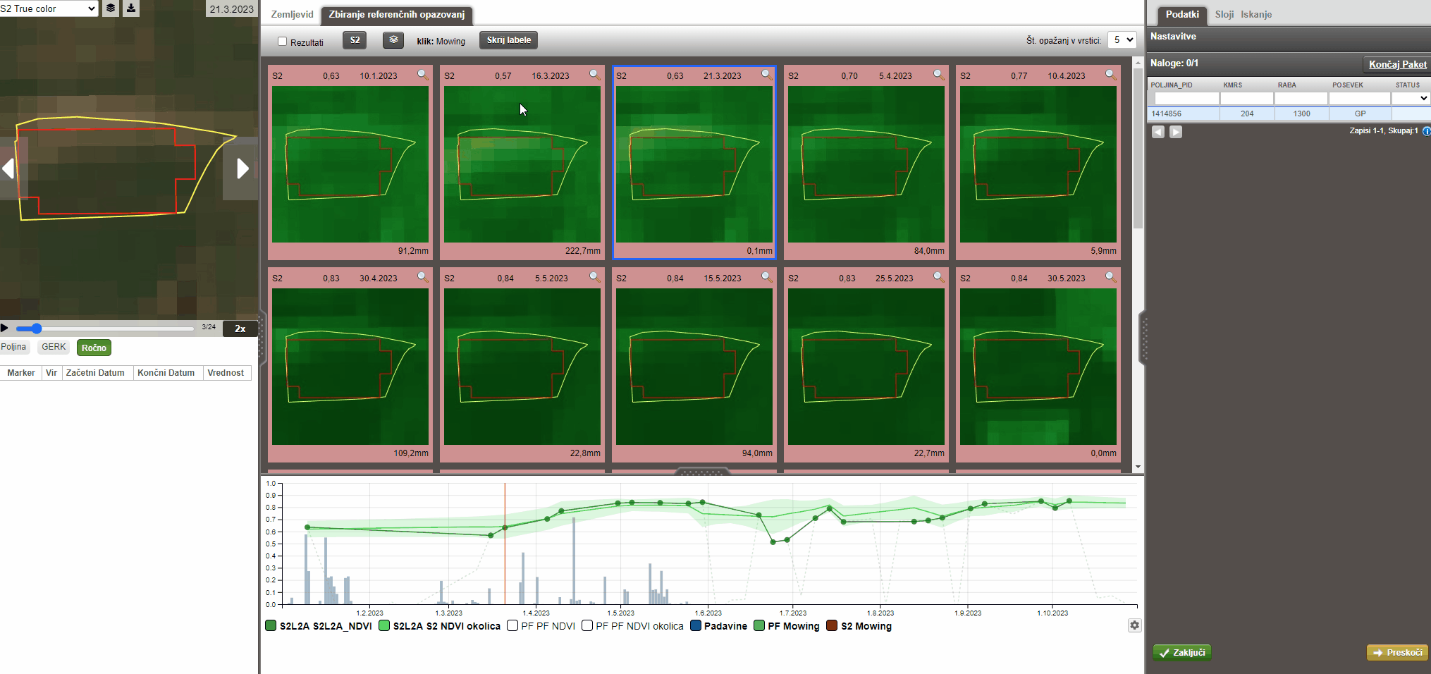
Results of such labbeling campaings can be used as valuable research source in order to fine tune our markers so we could improve results in itterative process.
Links
Blog post about Expert Judgement Application