Traffic Light System Examples
Slovenia use-case
Arable land
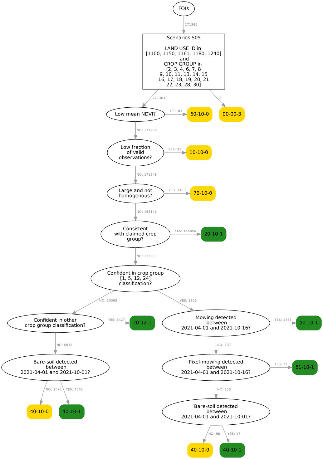
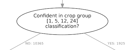
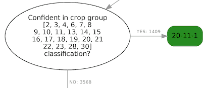
The decision tree for FOIs growing annual crops on arable land is visualized below. The decision tree utilizes information provided by the following markers: mean NDVI, bare soil, homogeneity, crop-group classification, similarity, distance, and mowing marker. The tree consists of internal (decision) and end leaf (decision taken) nodes. The latter are colored Green or Yellow, depending on whether markers provide evidence of farming activity or not. Each end node has a unique numeric identifier assigned, which is specific to the Slovenian project but irrelevant for understanding how TLS works and what value it provides. At the moment Red is not automatically assigned, but this will change in the future. Each internal node poses a question, where results of a marker are used to test a FOI's compliance with the rules. Numbers written next to the lines or branches that connect the nodes represent the number of FOIs that pass through this branch. From the diagram below, we can read that 171,365 FOIs fall under this scenario and 155,856 of them get a green assignment because the predicted crop group is consistent with the claimed one.
In the rest of the document, we'll walk through the diagram, describing in short the motivation for each decision node, and give a few example FOIs for some of the end nodes.
Scenario input
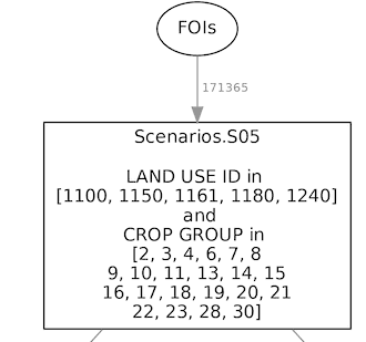
Input to this scenario are all FOIs claiming to cultivate annual crops on arable land. There were 171,365 such FOIs monitored with Sentinel-2 in Slovenia 2021. The query written in the topmost box selects FOIs that belong to this scenario based on their claimed land use and crop group types.
FOIs without or low fraction of valid observations
A very small number of FOIs have no or very few valid Sentinel-2 observations. These can't be confidently processed with the markers and are tagged as Yellow in end nodes 00-00-03 and 10-10-0, respectively.
FOIs with low mean NDVI
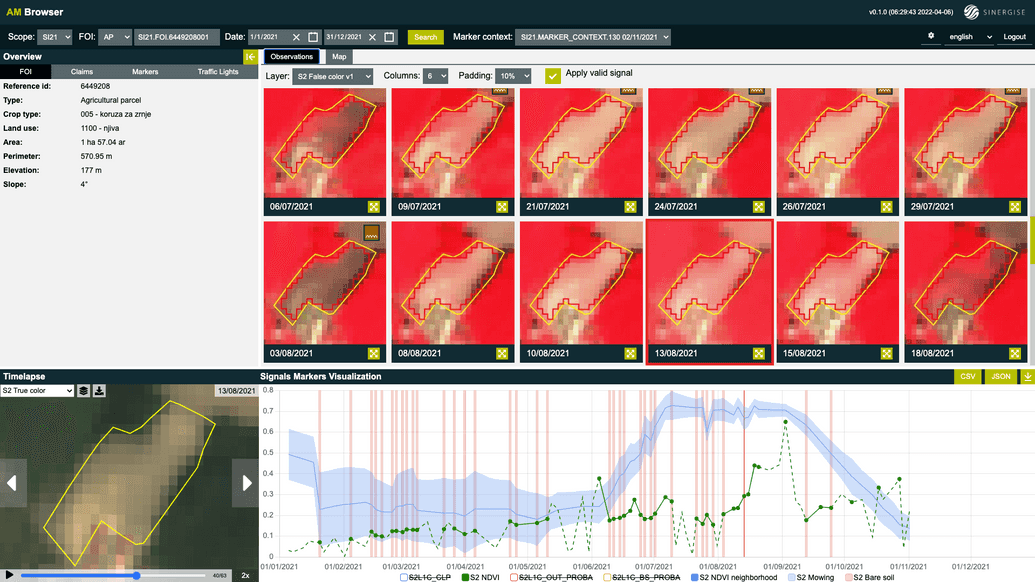
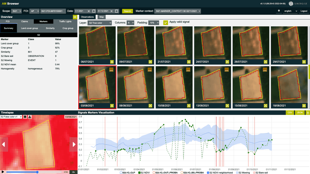
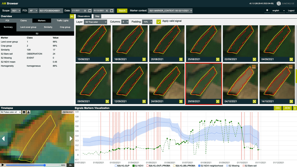
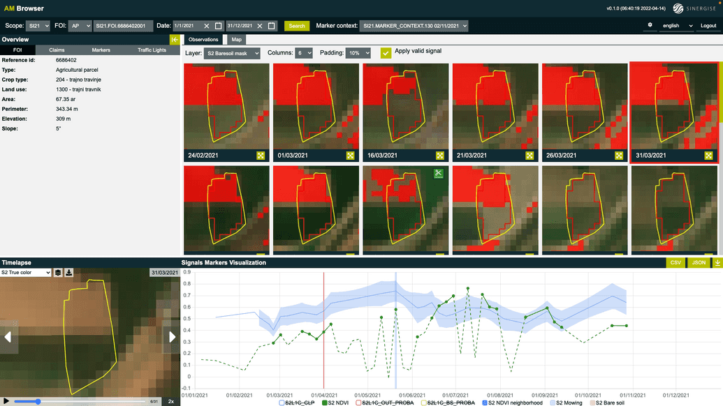
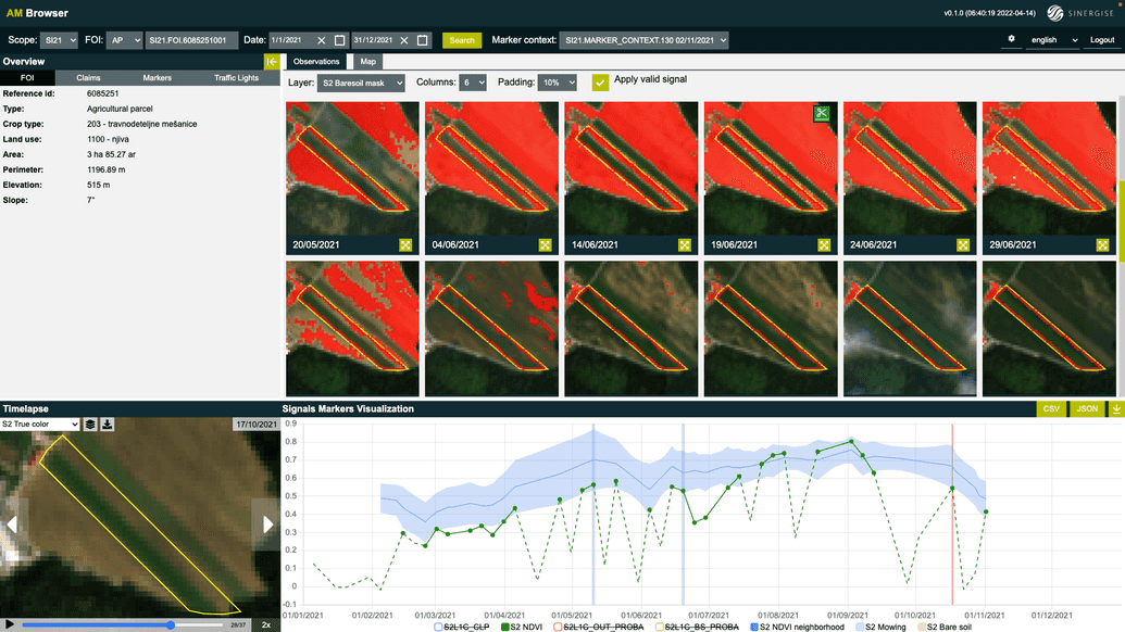
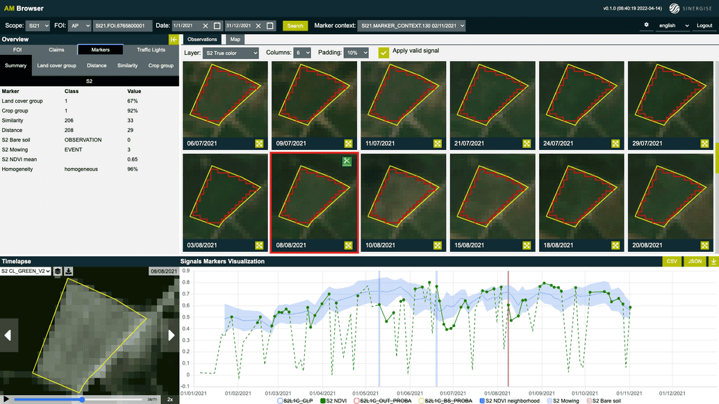
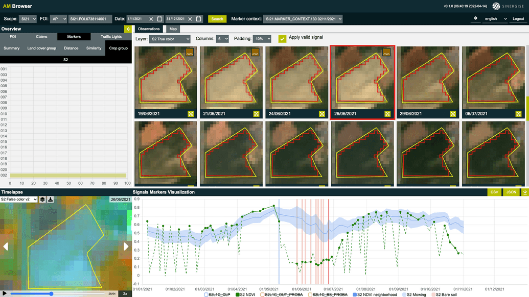
This node checks if NDVI averaged over all FOI's valid observations between the growing season of most plants (May 1 and October 15) is above a threshold. Vegetation should cover the area of a FOI for at least a fraction of the time, and if vegetation is present only shortly or not at all, then perhaps the area was not used for farming. One such example is a FOI (see screenshot below) that claims to grow corn. Signals and markers suggest that this FOI had exposed bare soil for most of the season, except for a short period in August. The data suggests that no crop was sown on the field.
Large and not homogenous FOIs
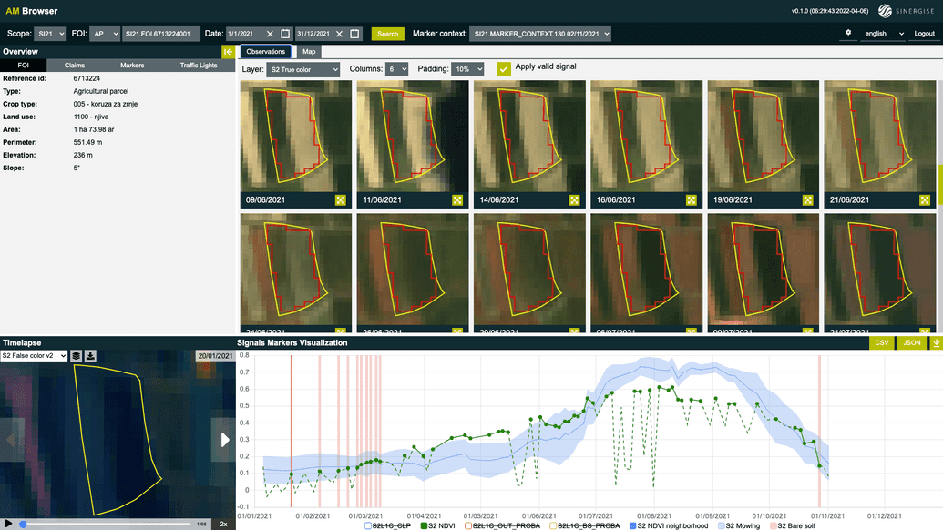
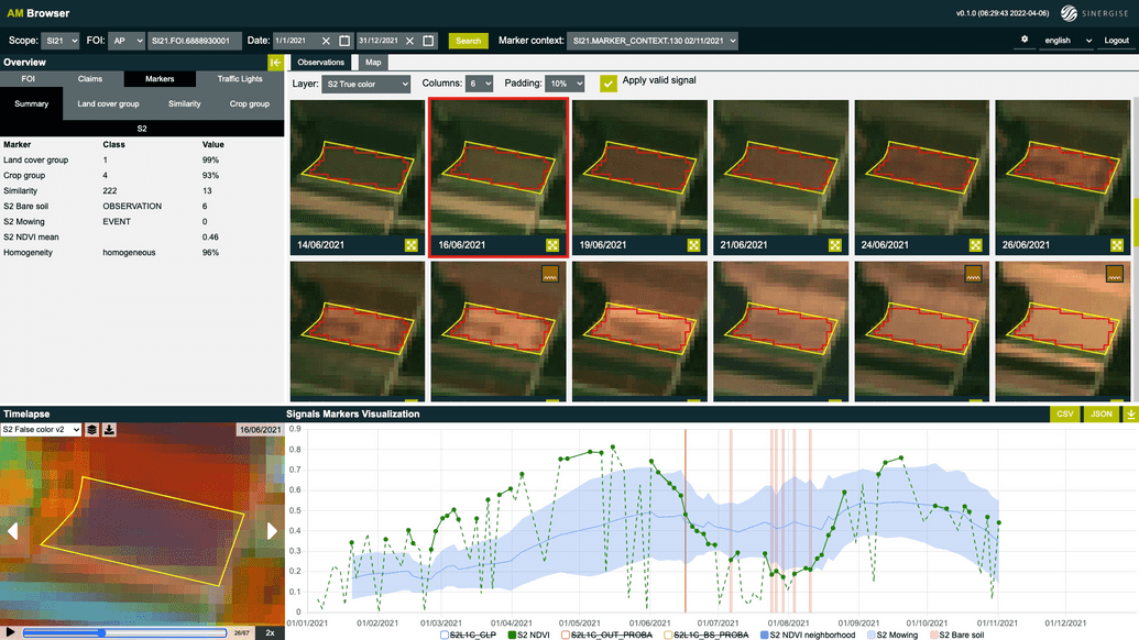
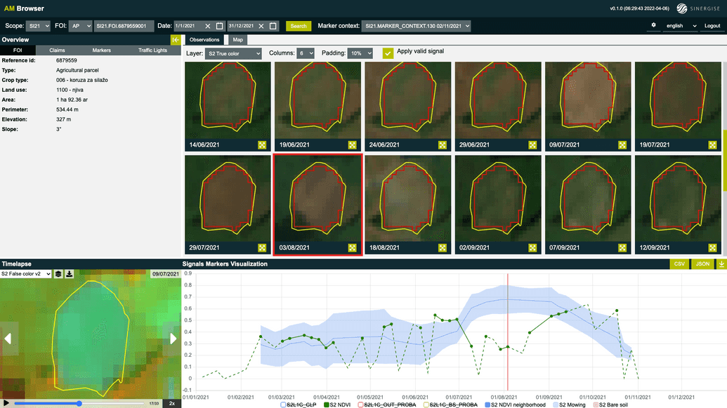
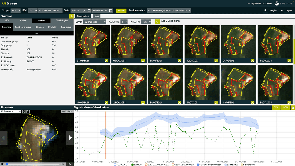
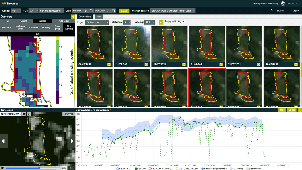
Next we check with the help of homogeneity marker if an area of a FOI represents homogenous land use or crop type. In the node Large and not homogeneous we declare all FOIs as heterogenous if they contain at least 9 Sentinel-2 pixels and have homogeneity marker output below a threshold. An example heterogeneous FOI in the screenshot below claims to grow corn. The NDVI of this FOI (green points) do not follow average NDVI signal of other FOIs growing corn in its neighborhood (blue line and blue band). We can see why is this from the Sentinel-2 observations. Left half of the FOI is used to cultivate a crop in the beginning of the season, which is harvested around end of June. Right half of the FOI is bare in the beginning of the season. In June vegetation appears. Most probably corn is cultivated only on the right half of the FOI.
Consistent with claimed crop group
Consistency with claimed crop group is checked by crop-group classification, similarity and distance markers. These markers are used as proxy for detecting farming activity, since annual crops don't grow by themselves. Below we give a few example FOIs that are given green assignment in this node. If a FOI fails at this node, it still doesn't get assigned a Yellow, since the main basic payment scheme requirement is that farmland is farmed. It's not important what kind of crop is cultivated on arable land, as long as it is being farmed. In the remaining nodes of this tree we check if signals provide any evidence of farming activity. If the answer is yes, then a FOI that fails crop-group consistency check can still get a green assignment.
| Consistent with claimed winter wheat | Consistent with claimed corn |
|---|---|
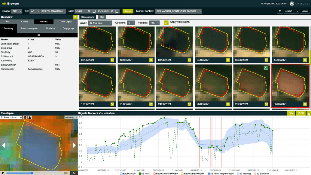
|
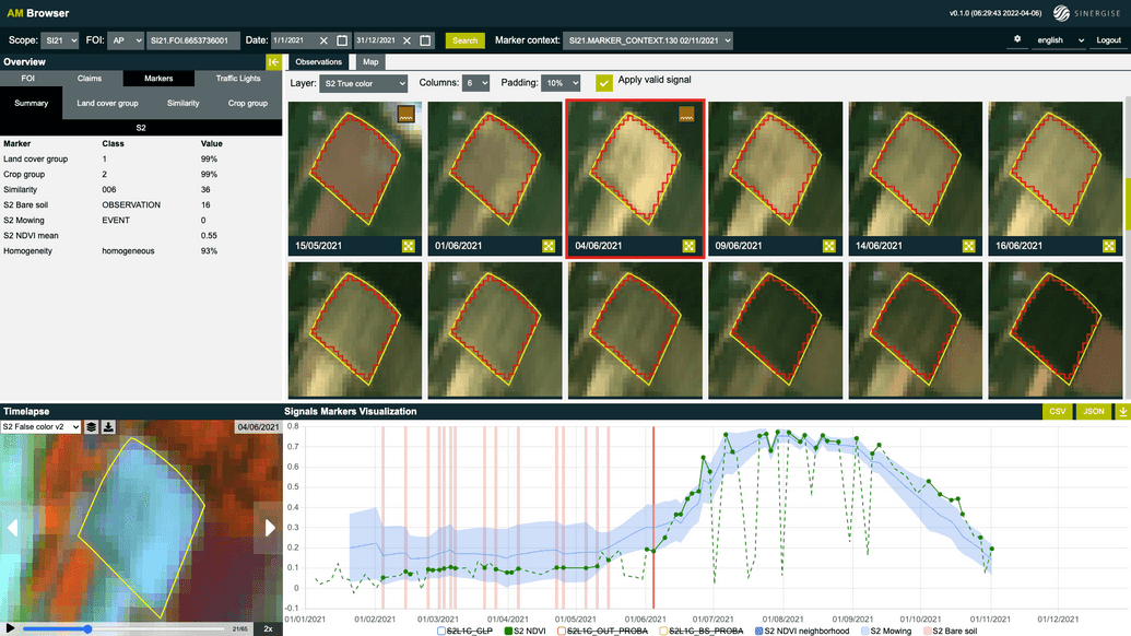
|
| Consistent with claimed summer oat | Consistent with claimed winter barley |
|---|---|
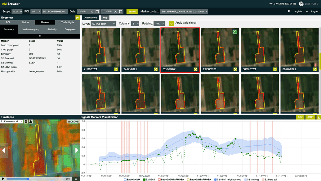
|
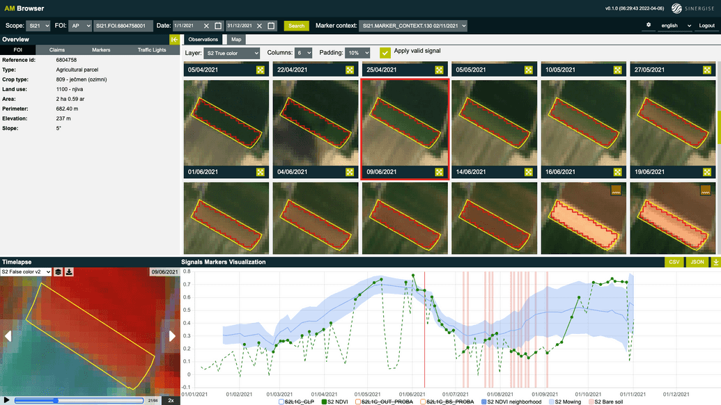
|
Crop group prediction consistent with grassland
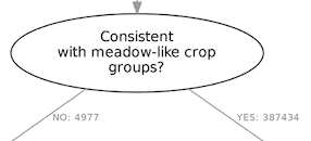
FOIs that reach this node are inconsistent with the claimed crop group. This means that the signals suggest that something else is cultivated on a FOI. This can be another type of annual crop cultivated on arable land or it can be grassland growing on arable land, or even permanent meadow. In this node we divide FOIs with wrong claims into two groups: the first one (following the YES branch) consists of FOIs that are predicted to grow grass, clover, grass-clover mixtures, or are permanent meadows. The second one (following the NO branch) consists of FOIs that are predicted to grow some other annual crop on arable land. FOIs need to be divided into two groups because the farming activity expected for these two groups is different. FOIs from the first group are expected to be mowed, while the FOIs from the second one are expected to be ploughed. We therefore look for mowing events on the right-hand side and bare-soil observations on the left-hand side of the decision tree below this node.
(Pixel) Mowing detected
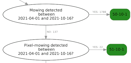
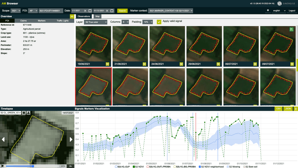
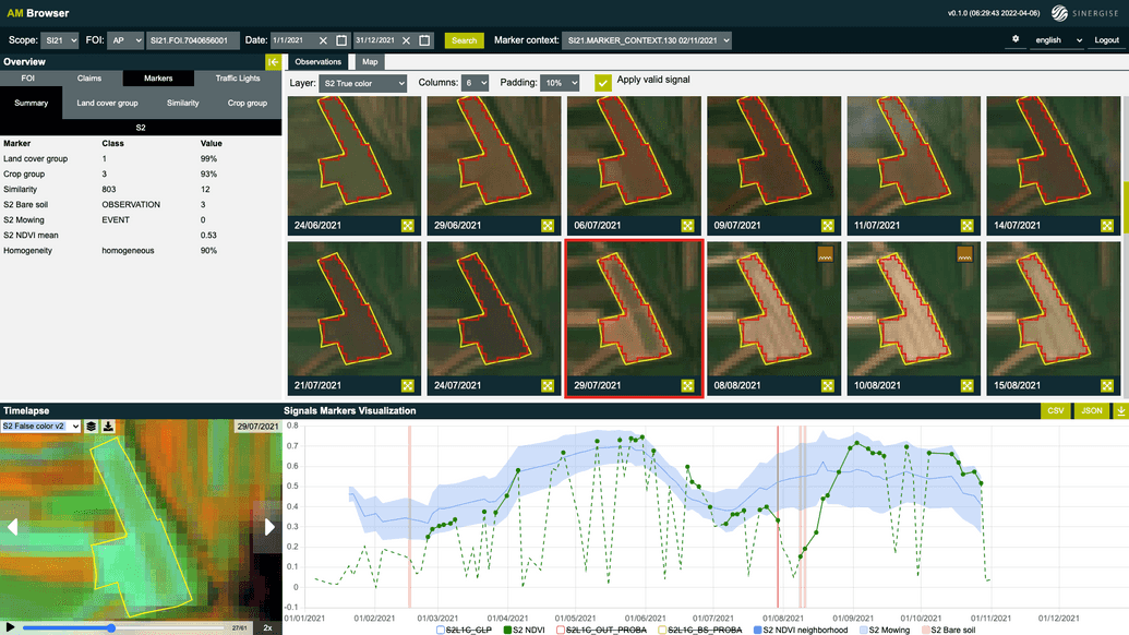
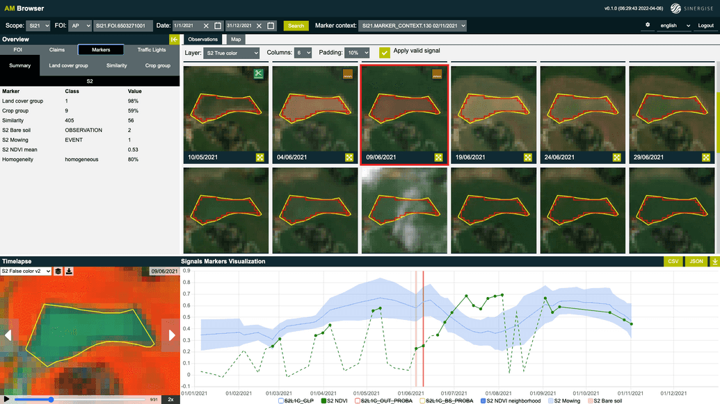
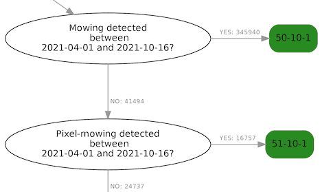
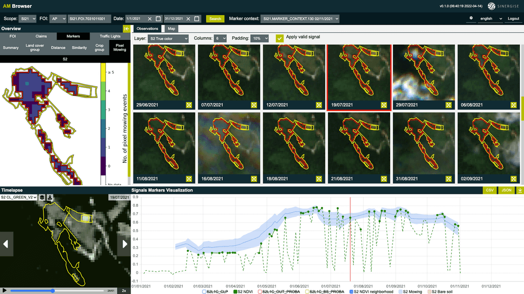
As explained above FOIs that go through the right-hand part of the decision tree are most likely growing grass, clover, grass-clover mixture or are permanent meadows according to the crop-group classification marker. The expected farming activity on these FOIs is mowing. If mowing event is detected, then these FOIs get assigned green. An example FOI below is claimed to grow winter wheat. Crop-group classification and similarity markers disagree. Both of them suggest that grass-like crop is growing on this FOI. Mowing marker detects three mowing events: one in June, one in July, and one in August. Bare-soil marker identifies no observation as bare soil.
Confident in other crop group
Business rules for Basic Payment Scheme in Slovenia don't require that claimed crop is being cultivated. What matters is that land is being farmed. This means that if crop-group classification marker is confident that some other crop is cultivated on a FOI and not the crop being claimed, then such FOI still needs to get a green assignment. The reasoning being the same as in the case of Consistent with claimed crop group node described above. Below we show a few example FOIs for which the predicted crop group differs from the claimed one, but signals and markers confirm that FOI is being farmed.
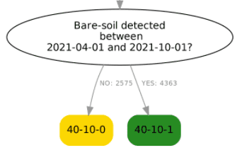
Bare-soil detected
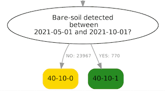
The last node in both parallel branches of the tree checks, if bare-soil has been detected, which indicates that a FOI has been ploughed and thus is being farmed.
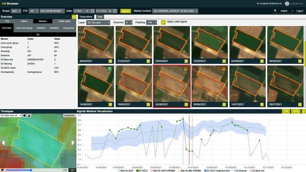
Example below claims to grow triticale. Crop-group classification marker is not convinced in its prediction. Nevertheless, two bare-soil observations have been identified at the beginning of June. NDVI raises quickly after that indicating that some crop has been sowed in the beginning of the summer. Signals and markers suggest that this FOI is being farmed.
Next example gets assigned Yellow by this node. This FOI claims to grow corn, which is not supported by the signals and markers as shown in the screenshot below. It seems that vegetation never really develops on this FOI and bare soil is also not detected. Since no evidence of farming is found the FOI is assigned Yellow.
Grassland
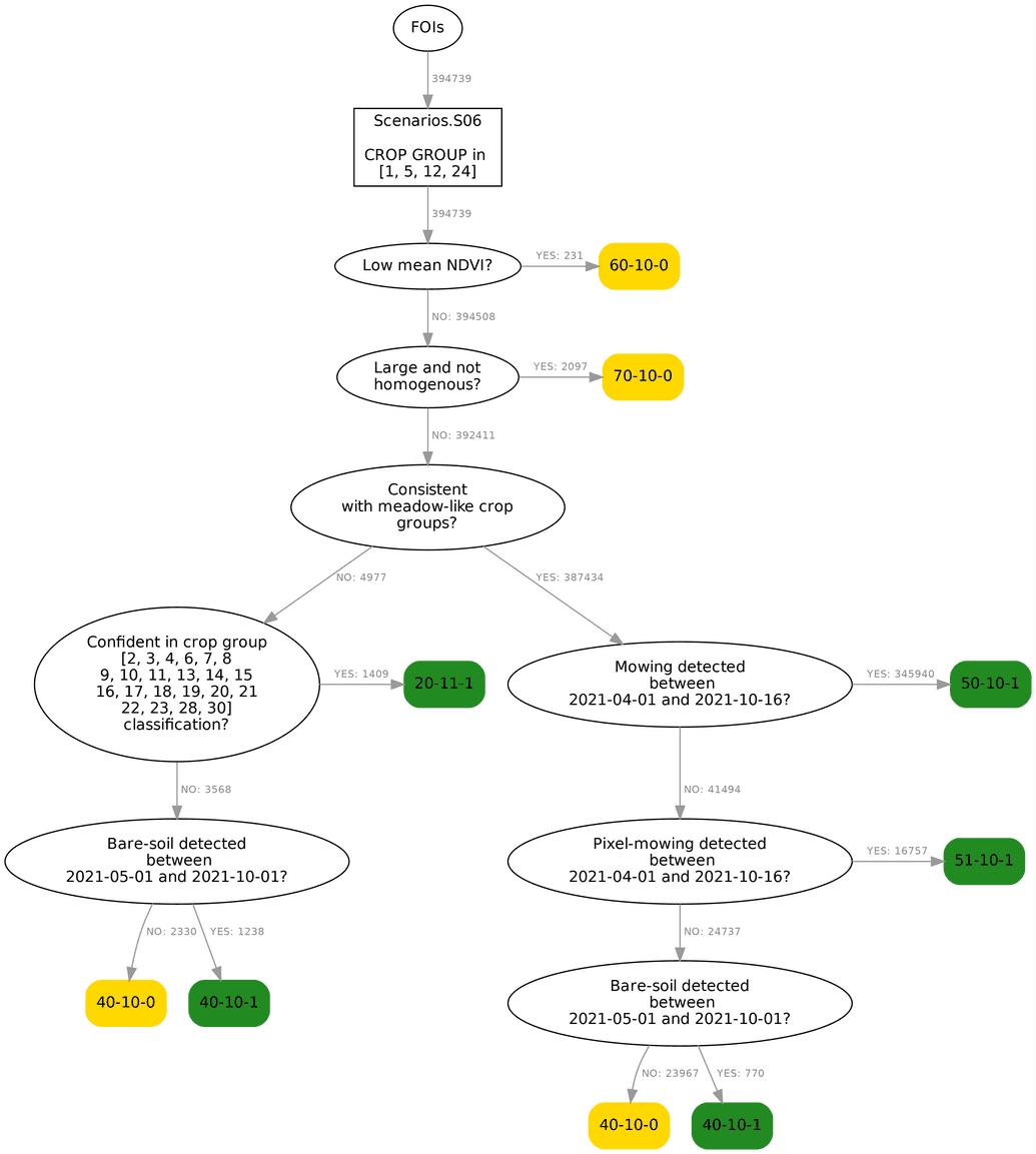
The decision tree for grassland FOIs is visualized below. Grassland FOIs in Slovenia consist of FOIs on arable land growing grass, clover, grass-clover mixtures up to five years, and of permanent meadows. The decision tree utilizes information provided by the following markers: mean NDVI, bare soil, homogeneity, crop-group classification, similarity, distance, and mowing marker. From the diagram below, we can read that 394,739 FOIs fall under this scenario and over 360 thousand of them are found to be consistent with claimed crop group and have at least one mowing event detected with regular or pixel mowing markers.
In the rest of the document, we'll walk through the diagram, describing in short the motivation for each decision node, and give a few example FOIs for some of the end nodes.
Scenario input
Input to this scenario are grassland FOIs claiming to cultivate grass, clover, or grass-clover mixtures on arable land and permanent meadows. There were 394,739 such FOIs monitored with Sentinel-2 in Slovenia 2021. More than half of all monitored FOIs in Slovenia go through this scenario. The query written in the topmost box selects FOIs that belong to this scenario based on their claimed crop group types.
FOIs with low mean NDVI
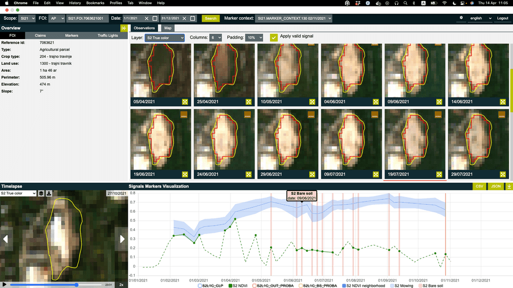
Grassland FOIs are expected to be vegetated throughout the season, especially during the summer. If a FOI claimed as grassland has an extremely low mean NDVI value, then this strongly suggests that in fact it is not a grassland FOI. At the moment such FOIs are assigned Yellow, but in the future they will get assignment Red. Below we show an example FOI that ends in this node. Sentinel-2 imagery and signals suggest that a permanent meadow has turned into a construction site in April and at the end of October a bright built-up area is seen.
Large and not homogeneous FOIs
In the node Large and not homogeneous we declare all FOIs as heterogeneous if they contain at least 9 Sentinel-2 pixels and have homogeneity marker output below a threshold. Below we show 4 example FOIs identified to be heterogeneous (not homogeneous) by the homogeneity marker.
Crop-group prediction consistent with grassland crop groups
FOIs that are found to be consistent with the claim by crop-group classification, similarity or distance markers don't get a green assignment yet. An additional requirement is that they are mowed as well. Since claims can and are wrong, and among FOIs that enter this scenario are also fields cultivating annual crops, where mowing is not expected, we need to split FOIs into two groups. The first group (follows the YES branch) consists of FOIs that are predicted to grow grass, clover, grass-clover mixtures, or are permanent meadows. The second one (following the NO branch) consists of FOIs that are predicted to grow some other annual crop on arable land.
(Pixel) Mowing detected
These two nodes are the most important nodes of this scenario. Grassland FOIs are required to be mowed at least once per year in the specified time interval. Example FOIs below have detected either FOI-level or pixel-level mowing.
Consistent with annual crop
Business rules for Basic Payment Scheme in Slovenia don't require that the claimed crop is being cultivated. What matters is that land is being farmed. This means that if the crop-group classification marker is confident that some other crop is cultivated on a FOI and not the crop being claimed, then such FOI still needs to get a green assignment. FOIs within this scenario have a claim to cultivate grass, clover, or grass-clover mixtures on arable land. But this is sometimes not true and for example corn is cultivated on the field. Such FOIs are diverted into the left-hand branch of the scenario's decision tree. In this branch the requirement of at least one detected mowing event doesn't make sense. Instead the presence of other evidence of farming activity needs to be tested. As in the case of annual crops on arable land scenario we use crop-group classification, similarity and distance markers as a proxy for detecting farming activity. An example below is declared as permanent meadow, which however can't be confirmed by signals and markers. The area of the FOI was vegetated in the beginning of the year, which is consistent with the claim. In May, however, the FOI was ploughed and annual crop has been sown. Based on NDVI time series, results of crop-group classification marker and similarity marker it seems that corn has been sown.
Bare-soil detected
The aim of this condition is to assign Green to all FOIs that are being farmed, even if the claim is erroneous and any of the previous markers failed to provide evidence of farming activity. All FOIs reaching this point are assigned Green, if bare soil is detected within the specified time interval. The example below is similar to the one above. The main difference is that neither the crop-group classification nor the similarity marker provide high confidence about what is really growing on this FOI. However, regardless of what crop type is truly growing on this FOI, because the bare-soil marker makes conclusive bare-soil observations, there is sufficient evidence of farming activity to assign green.
FOIs without evidence of farming activity
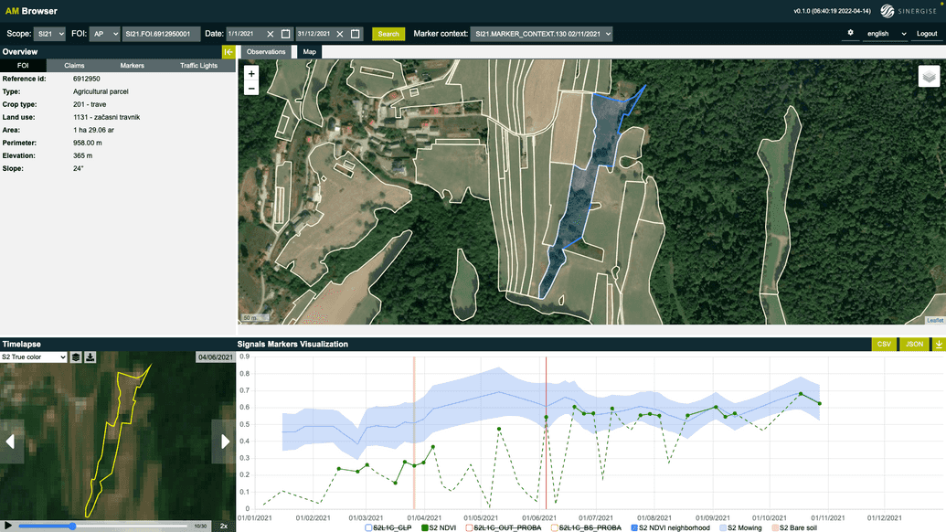
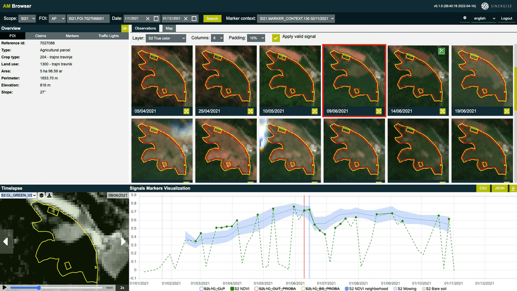
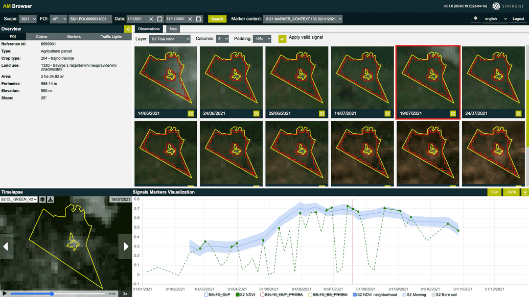
FOIs that end up at the very end node of this decision tree are those for which marker results provide no strong evidence of farming activity. These are typically FOIs that are consistent with the claimed group, but no conclusive evidence of mowing or ploughing is seen in satellite-derived signals and markers. An example below was claimed as meadow. Crop-group classification, similarity and Euclidean distance markers suggest that this is really a meadow, however the mowing marker does not detect any events. NDVI time series and Sentinel-2 imagery also do not provide any evidence that this FOI has been mowed or ploughed.
